|
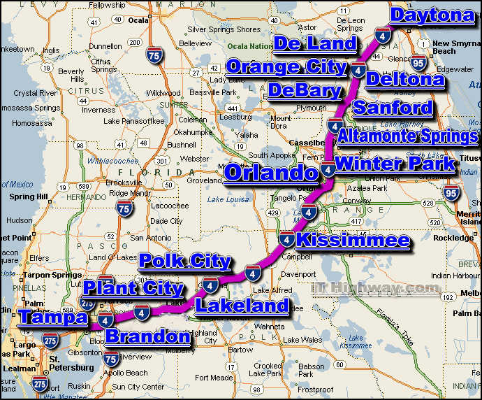
The i-4 is an Intrastate Interstate Highway that travels generally in a
northeast-southwest direction entirely within the state of Florida.The i-4 is the main route
east-west route across the mid section of Florida - traveling between the east
coast of Florida and the west coast of Florida.
The city of Daytona Beach is located at it's eastern end ... and the city of
Tampa
is located at it's western end.
The major interstate highways that intersect the i-4 include the;
i-75 and i-95.
The i-4 covers a distance of aprox. 132 miles ... which can
be travelled in aprox. 2.2 hrs. with a sustained travelling speed averaging 60
miles-per-hour.
Some of the cities located along the i-4 corridor include;
|